 Book holidays
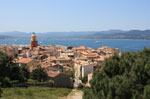 holiday Rental
 Stays in residence
 discounts
 Book hotel
 Stays
Stays Excursions
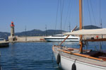 Sailing and Boating
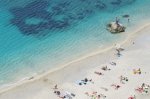 Beaches and seaside
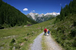 Hike
Hike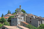 Tourism
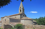 Discoveries
 Cinemas
 Films
Films Restaurants
 Recipes
 Activities
 Outings
 car rental
 Corsica Ferries
 Good ideas on the Riviera
 World within reach of Nice
 Airline Tickets
 Real Estate
 Classified Ads
 Facebook
 Photo of the Week
 Agenda of the week
 Calendar
 Horoscope
 Events
 Our favorites
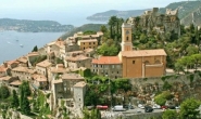


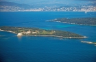
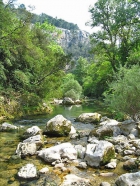
Escapade Take a stroll along Cap Ferrat

The seaside being difficult to access in summer, we advise you to go to Beaulieu-sur-Mer by taking the train. In only a few minutes from Nice and for little cost, you will arrive at the small railway station of Beaulieu which is ony five minutes by foot from the edge of the sea.
We also advise doing this stroll during the morning, so as not to suffer too much from the heat.
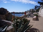
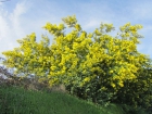
Even if, from first glance, the sky-blue coast line seems somewhat inaccessible due to the all the property development going on, it nonetheless offers some great opportunties for beautiful walks, paddling and being surrounded by luxurious flora.
 We thus invite you to discover the coastal pathway which links Beaulieu-sur-Mer with Saint-Jean Cap-Ferrat and which runs along the whole length of Cap Ferrat as far as the bay of Villefranche-sur-Mer.
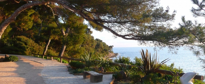
The Maurice Rouvier Walk
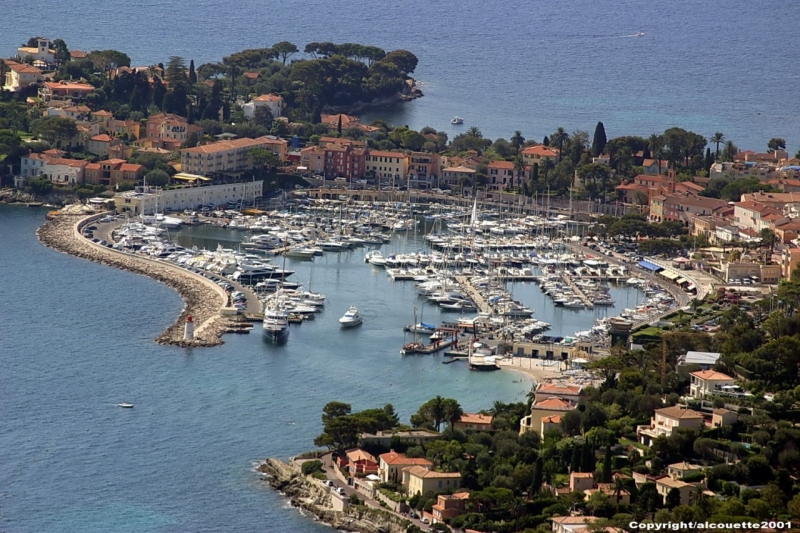
 Opposite the Beaulieu casino, you will find the departure point of the Rouvier pathway, a pleasant walk along the crystal clear water taking you to the port of Saint-Jean Cap-Ferrat passing by the beautiful Royal Riviera Hotel.
Along the whole length of this lovely stroll, you can take in the seriously pretty view of the Villa grecque Kerylos (the Greek Kerylos Villa) and within only half an hour, you will arrive at the Saint-Jean port where the following pathway begins, that of Cap-Long.
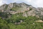
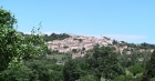
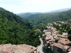
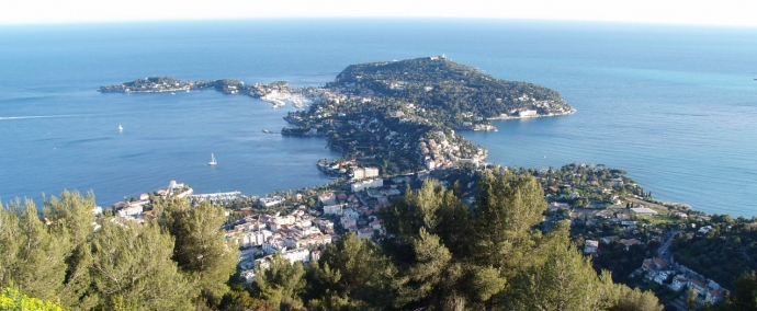
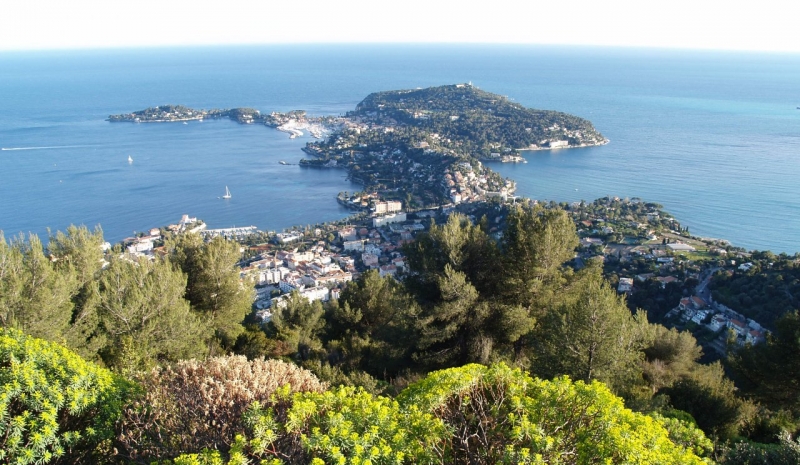
The Cap-Ferrat Pathway
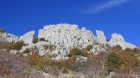
 This pathway goes the whole way round the Saint-Jean Cap-Ferrat peninsula and measures about 6 km, representing two hours on foot. You start the walk by going along the whole length of a former quarry from which the rocks were used to build the port of Monaco, from there, there is a well marked route mapped out by arrows, taking you through very different types of countryside : sharp chalky and limestone rock, a wonderful luxury hotel in the style of the Beautiful Era by means of the Grand Hôtel du Cap-Ferrat, wild nature completely covered by pine-trees
.. with the Mediterranean countryside in the background.
This pathway goes the whole way round the Saint-Jean Cap-Ferrat peninsula and measures about 6 km, representing two hours on foot. You start the walk by going along the whole length of a former quarry from which the rocks were used to build the port of Monaco, from there, there is a well marked route mapped out by arrows, taking you through very different types of countryside : sharp chalky and limestone rock, a wonderful luxury hotel in the style of the Beautiful Era by means of the Grand Hôtel du Cap-Ferrat, wild nature completely covered by pine-trees
.. with the Mediterranean countryside in the background.
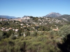
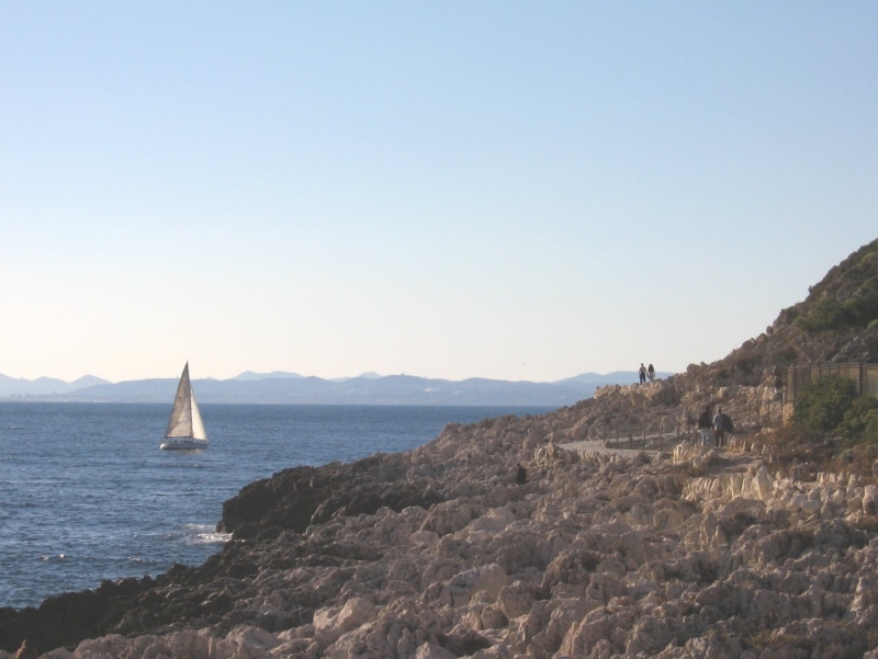 Along this route, you will discover the Caps lighthouse which for a whole century has been the main guide for sailors. Built by the Sardinians in 1827, it was destroyed during the Second World War and then re-built in 1951. Closed to the public all year round, you can nonetheless visit it during Heritage Days. It is a visit not to be missed, the view from high above is absolutely unbelievable!
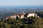
 The pathway then threads through to an area where there are little coves and creeks along with spiky rocks finally arriving at plage de Passable (the Passable beach) where it ends. Now climb back up a few steps and a little road end before crossing the main road known as the D25 where you will find the national tourism office next to which there is a short cut to the centre of Saint-Jean.
22 Juin 2016 - Amandine
the line is an indicative and approximate line