 Réserver ses vacances
 Àðåíäà íà îòïóñêíîå âðåìÿ
 Séjours en résidence
 Ñïåöïðåäëîæåíèÿ
 Réserver hôtel
 Ïðåáûâàíèå
 Ïðîãóëêè
 Âîäíûé ñïîðò
 Ïëÿæè è ïðèáðåæíàÿ çîíà
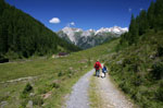 Rando
Rando Òóðèçì
 Ýòî èíòåðåñíî
 Êèíîòåàòðû
 Ôèëüìû
  Ðåñòîðàíû
 Ðåöåïòû
 Âèäû äåÿòåëüíîñòè
 Ðàçâëå÷åíèÿ
 Ïðîêàò ìàøèí
 Ferry Corse
 Bons plans Côte d'Azur
 Monde portée de Nice
 Áèëåò íà ñàìîëåò
 Íåäâèæèìîñòü
 Îáúÿâëåíèÿ
 Facebook
 Photo de la semaine
 Ñïðàâî÷íèê íà íåäåëþ
 Âðåìÿ âîñõîäà è çàõîäà ñîëíöà
 Ãîðîñêîï
 Ñîáûòèÿ
 Ëó÷øèé âûáîð
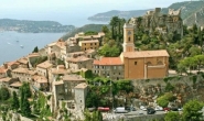

Gorges de l'Estéron - Estéron - Moyen Pays
Êàðòà IGN : "Vallée de lEstéron" TOP 25 n° 3642 ET 125.000e
Èíôîðìàöèÿ
- Ãåîãðàôè÷åñêàÿ çîíà : Estéron
- Ïåðèîä : avril à novembre
- Ñëîæíîñòü : rando moyenne
- Ïðîäîëæèòåëüíîñòü : 4h15
- Ïîäüåì : + 640 m
- Ñïóñê : - 640 m
«Ïðîãóëêè Crêtes du Bauroux Ïåøèå ïðîãóëêè Estéron Ïðîãóëêè Mont Saint-Martin»

Contact rando : rando@cote.azur.fr